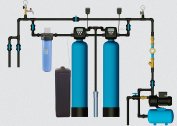
Water is the source of life. It is needed both to quench thirst, and for household needs. Therefore, for those who live far from large settlements, a well or well is the only source of water. In order to properly provide your site with water, you need to know what an aquifer is and at what depth it is.
What is an aquifer?
 An aquifer is a section of soil located in the thickness of the earth whose cavities and cracks contain water. This water is constantly in motion. It is this layer that is sought during drilling in order to then have constant access to water.
Aquifer parameters:
- Depth. Measured in meters from the earth's surface;
- Power. This refers to the thickness of the soil, which is saturated with water;
- Performance. The volume of water, measured in cubic meters, per unit time. It is important to know that the deeper this layer, the more constant its performance.
- The amplitude of water fluctuations during the year, which depends on the amount of precipitation, season, temperature, and atmospheric pressure.
Types of aquifers
 Aquifers are separated depending on their location, namely on their deepening from the surface of the earth. So, there are the following types:
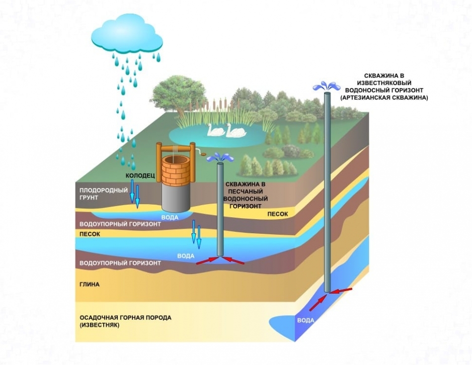
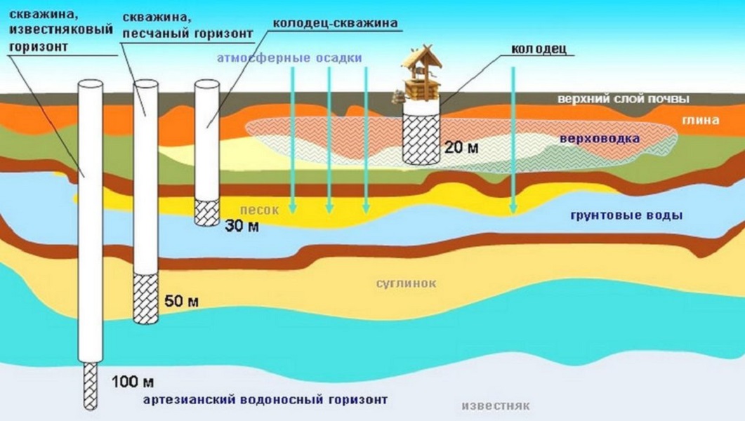
- High vault. This layer is very close to the surface of the earth, sometimes at a depth of only five meters, the replenishment of which comes from precipitation. Therefore, at high ambient temperatures and with a decrease in precipitation, the water here can be greatly reduced or even disappear. It must be remembered that this layer absorbs everything that enters with precipitation and runoff: pollution from the soil and atmosphere, waste from enterprises and toilets with a cesspool. For this reason, it is dangerous to use the water of this layer if there is a cemetery, street toilets or industrial enterprises near it. In addition, oxygen content is high in such water, which results in a high content of living microorganisms in it. In the northern regions, this layer is often subjected to freezing, so water intake from it will be difficult.
- Ground water. The depth of this layer is ten meters from the earth's surface. Its support is a layer of clay. According to experts, the water from here is also not clean enough, since this depth is not enough for its high-quality natural filtration.
- Interstratal waters. They are located at a distance of fifteen to one hundred meters from the surface of the earth. Often, fluid is located between two watertight formations. This water is stable. But at the same time, it can have a high concentration of metal salts and minerals, which it absorbs throughout its path. The use of this resource is possible after conducting research and selecting the appropriate filtration system.
- Artesian waters. The location of these waters is at a depth below one hundred meters. It is this resource that is as clean as possible, since a large number of stages of natural natural filtration have passed. In accordance with the law of the Russian Federation “On Subsoil”, the state controls all artesian wells, therefore, for its drilling and further use, it is necessary to obtain an appropriate license.
In addition, there is another classification of aquifers. They are divided into pressure and non-pressure. So, pressureless layers are located very close to the earth's surface, and therefore their productivity is unstable.As for the pressure layers, they are located deep underground, therefore, they do not depend on the ambient temperature and the amount of precipitation.
Aquifer map
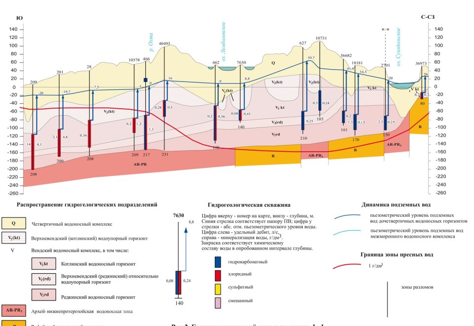 During the implementation of hydrogeological studies in a certain area, special documents are compiled without fail. These include, among others, maps with which you can find out the location of different types of aquifers, as well as their depth. This allows you to quickly search for the source of the resource, as well as select the appropriate equipment for drilling the well.
Such maps can be found in the archives of the respective locality.
Aquifer maps are of the following types:
- Hydroisogypsum. This map contains information on pressureless formations. It displays the system of water movement, due to which it is possible to determine the direction of the resource, sources of saturation and discharge of this layer, slope, places of docking with water bodies.
- Hydroisopiesis. It is compiled exclusively on accurate data for artesian sources.
- Map of the amplitude of the liquid levels in the sources.
How to determine the water level while drilling
The exact depth of the aquifer can be determined by experts. But there are certain methods and even folk signs with which you can approximately find out the level of water.
So, choosing sand during drilling, you need to pay attention to its type. The finer the grains of sand, the closer the water. If grains of sand are large, then the aquifer is at a depth of more than eight meters.
In addition, it is important to pay attention to local plants. In those places where the vegetation is lush and juicy even in the heat, the water is located close to the surface. So, each plant prefers places with a different arrangement of groundwater. Here are some plants to pay special attention to:
| Plant | Estimated aquifer depth |
| Rogosa | one and a half meters |
| Reeds | one to three meters |
| Sarsazan | up to five meters |
| Sagebrush | seven meters |
| Sand wormwood | nine to ten meters |
| Alfalfa | fifteen meters |
It is also important to give importance to the root system of plants. If their root system is weak, then the groundwater is not removed from the surface. If the roots are massive, then the aquifer is deep enough.
How to know the depth of an already drilled well
When a well has already been drilled, sometimes it is necessary to determine its depth. For this purpose, you can use special tools, such as:
- Hydrogeological roulette. She measures depth to fifty meters. In case of its absence, you can use a cord with a weighting agent. As a weighting agent, you can use a brick or some metal object.
- Special logging cable. This tool has a measuring roller, one unwinding of which is equal to one meter.
- Depth gauge. This device allows you to measure the angle and depth of the well by means of an echo signal that is sent and then reflected from its bottom.
In order to provide a land plot with water through well drilling, it is necessary to be able to correctly determine the location of groundwater, as well as their depth. This can be done with the help of special cards and tools, as well as with the help of folk signs.