A passport for a well is an official document that indicates the characteristics and characteristics of a source. When drilling a well from an artesian layer, the legislation requires such documentation. If the depth of the source is small, then it is not necessary to draw up documents, but in case of technical malfunctions it will come in handy.
Why get a passport for a well

Artesian water is a valuable source of the country, so its production should be legal and fully legal. In the passport, the cadastral number is assigned to the water intake source, which is also entered in the unified state register. It follows from this that the source is registered as an object of environmental management.
A passport is required not only to confirm legality, but also for practicality. It lists the technical characteristics that are needed to repair, select and install equipment, calculate the necessary parameters.
The document is drawn up by the organization that was involved in the drilling of the well and its arrangement. It is mandatory to carry out certification. Some organizations start paperwork “by default” shortly after completion of work. A certificate of acceptance of the work done and an act of transfer to the customer are also issued without fail.
What information is indicated in the passport of the intake source
Issuing a passport greatly facilitates the tasks of the owner in the future. There is no single standard form for filling in the data, therefore, the samples of the well passport for water differ in appearance. The type of document depends entirely on the driller. But there is a norm that must be taken into account when preparing documentation.
The following information must be indicated in the passport to the water intake source:
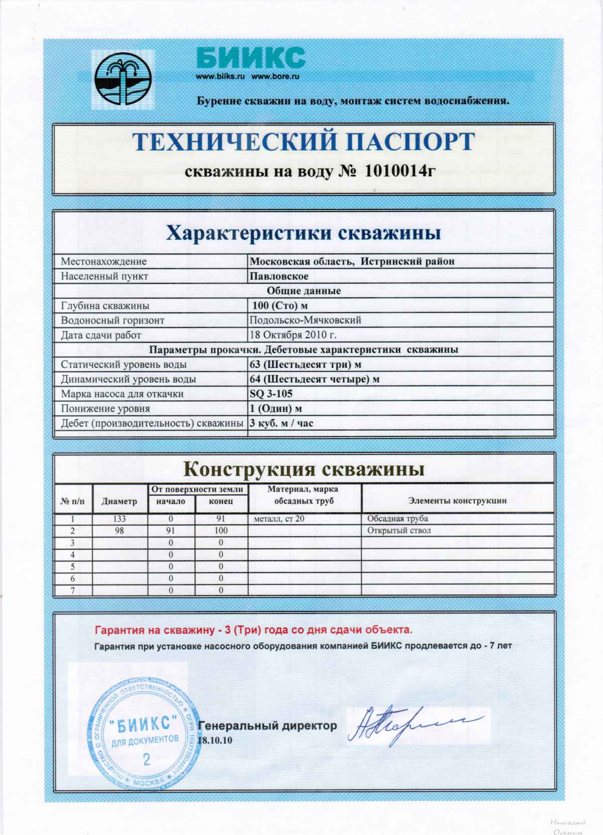
- The depth of the aquifer. These parameters must be set by drillers while drilling the soil.
- Well depth. It is not only actual, but also dynamic. Features of the calculations are different.
- Drilling technology. This process is divided into two types: in 1 column or in 2. In the latter case, the depth is recorded in the passport to drill with a large diameter.
- Static water level. The procedure for measuring this indicator is best entrusted to professionals, since they have the necessary equipment and knowledge. This level is located in the interval from the water mirror to the soil surface (provided that there is no water intake for some time). The parameter is calculated only after the water level is restored to an absolute maximum.
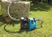
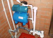
- Debit device. This is the maximum possible volume of fluid that arrives during the operation of the pumping station per unit of time. Characterization sometimes plays a fundamental role in the selection of equipment. Pumps should not work “idle”, their task is to pump out the volume of liquid that is capable of renewal. If this feature is neglected, the source may be emptied or expensive pumping equipment will fail.
- Dynamic water level in the source of water intake. When the pump starts, a drop in the water level is recorded to the point where the pumping of the unit is compared with the natural restoration of moisture. This item should be filled by the driller himself with his own hand.
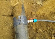
- The inner diameter of the casing and the materials of which it consists. The item is clear enough and easy to understand.Information is important because it will allow you to choose the right pumping equipment for lifting liquids to the surface.
- Detailed description of the downhole filter characteristics. It is indicated only in documents for sandy wells. A detailed filter drawing with mesh parameters, slot diameter, and length is appropriate. The knowledge of these indicators will make it possible to carry out a planned cleaning of the structure and its repair work without further hassle.
- Information about the geological and lithological section. A schematic description where all the soil layers are fixed with an indication of the beginning and end of their occurrence. It is useful for homeowners to know this information during construction work.
It is important that the chemical and bacteriological composition of the water from the well comply with all standards. There is a whole list of signs that determine water suitable for consumption for food purposes.
Determine the quality of the liquid will allow only a special analysis, the data must be indicated in the passport. For the analysis, a sampling of material is taken and transported for examination. The optimal time for quality control is two weeks after the completion of drilling operations, when the composition of the liquid returns to normal.
Additional Information
 It is much more difficult to build an artesian well on your own in a personal plot. It must be legalized and have all the necessary list of documents. The state owns all underground resources, including water, so any development requires permission to carry out work. Additionally, the passport contains the following information:
- source location;
- what method was used when drilling the well, what equipment was used;
- information on bacteriological analysis and chemical composition;
- name of the organization that was engaged in the construction and arrangement of the well;
- test pump data;
- all materials used (hoses, pumping stations, etc.);
- forced adjustments that differ from the accepted project;
- a detailed description of the actual source design;
- description of the design of filters;
- cement and cementing data;
- results of geophysical studies.
To simplify the design process, it is recommended to contact companies that not only make the well, but also submit all documents upon completion of work, taking into account all requirements. The cost of services varies widely depending on the depth and type of soil, and the price differs in different regions.